Aden, Connor, Jerad, and I spent the better part of a week traversing the Wind River Range, starting from the north at the Green River Lakes Trailhead and finishing in the south at the Big Sandy Trailhead. Along the way, we trekked over sublime alpine tundra, treacherous terminal moraine, boulder-strewn passes, and swift-moving glacial-fed creeks. We even tagged Gannett.
This was the third and final leg of Jerad and Aden’s trek across the Teton, Gros Ventre, and Wind River Ranges, where they would stay as high as possible and tag each range high point. I was lucky enough to join them for the Winds. This would be my second time in the range, and my first time ever traversing a range in its near entirety.
It may be helpful to reference this map along the way: https://caltopo.com/m/QA8D
Day 1: Kinky Creek TH - Slide Lake
Spirits waned as we made the 1.5hr drive back into Pdale, but I think we made the right call in retrospect. We could have done most, if not all, of the route without crampons, a helmet, and even an axe, but Gannett would require all 3.
At around 5PM we returned to the GRL TH and were off. The stoke rose once again as we cruised mellow trail past the Bridger Wilderness boundary and toward Slide Lake, our presumed destination for the night.
 |
| Happy to be out of the car |
 |
| Not fun. Still haven't figured out a reliable technique for tightroping over shifty/bouncy deadfall |
There was a second crossing shortly afterwards. It felt more secure, but no less consequential.
 |
| An evening at Slide Lake |
"Big days for big dads" was an oft repeated mantra throughout the first few days of the trip. It would become an ethic of sorts as we began to realize that nothing in the northern section of this range would be a gimme.
Day 2: Slide Lake - Baker Lake
 |
| A morning at Slide Lake |
We climbed at a reasonable clip up shifty boulders and microwave-sized talus. I slipped a couple of times, gouging a bit out flesh out of my right finger, and nearly losing my only water bottle to the morass of strewn boulders with cracks and crevices of unknown depths. This would be the main faire for most of the passes/climbs on the trip, and there's no better way to 'work up to it' than doing one of the hardest bits right at the start, with little physical preparation and a 35+ lb. pack no less.
Admittedly, I was worried that, while still more or less recovering from a recent bout with the novel coronavirus and spending 3 weeks at sea level, my body wouldn't be up to it and the first few climbs would be a real struggle. Luckily, I felt fit enough, and managed to keep pace with the Montanny boys. We snacked at the top and were ready for some mellow plateau walking.
Admittedly, I was worried that, while still more or less recovering from a recent bout with the novel coronavirus and spending 3 weeks at sea level, my body wouldn't be up to it and the first few climbs would be a real struggle. Luckily, I felt fit enough, and managed to keep pace with the Montanny boys. We snacked at the top and were ready for some mellow plateau walking.
 |
| Easy, hot. |
The mellow plateau walking did not last very long, and soon we were crawling in up-down, relentless terrain. I would much rather climb one or two big passes and roam basins all day, rather than the incessant short ascents/descents required for this section. Perhaps this would be less the case if we chose to stay low in the Slide Creek drainage and follow it all the way up to the plateau, but that seemed bushwhack-y, sidehill-y, and cliffy. So here we were, going up, down, up down.
 |
| Getting harder, getting hotter. |
 |
| I embraced any patch of flat, reliable, predictable snow. |
Arrived at our lunch site- the mouth of Pixley Creek- perhaps a bit too late because we all felt tired, hot, and hungry. After only a mile more of walking across the moraine separating Baker and Iceberg Lakes, we decided it'd be best to set up camp before tackling the next big climb that would gain the plateau above Grasshopper Glacier. After 45 or so mins of camp scoping, we settled for a rowdy site just behind a large boulder with excellent views of the Sourdough Glacier. It was lumpy, and with my sinuses inflamed and head throbbing, I realized my body was not yet adjusted to the dry air and high elevation, and so I slept awfully. But after 8.5 miles and 5k of vert, I was too tired to really care.
 |
| Camp 1 |
Day 3: Baker Lake - Dinwoody Cirque
(Track of the Day = "Terminal Paradise" by Adrianne Lenker)
(Track of the Day = "Terminal Paradise" by Adrianne Lenker)
 |
| Chances of contracting giardia from this water source: low |
(After a bit of reluctance, I finally plugged in the headphones for stretches of Day 3, and thus, the track of the day; or, the one song that boosted morale in a memorable way)
After a bit of deliberation, we decided that it would be best to gain the plateau west of Grasshopper Gl. and traverse southeasterly along the Continental Divide, and then over the glacier to the two unnamed lakes below it. This was our route last year, and it worked well. Gaining the plateau was straightforward, and the walking on the snowy plateau felt like a respite from the challenging terrain we experienced the day before.
After a bit of deliberation, we decided that it would be best to gain the plateau west of Grasshopper Gl. and traverse southeasterly along the Continental Divide, and then over the glacier to the two unnamed lakes below it. This was our route last year, and it worked well. Gaining the plateau was straightforward, and the walking on the snowy plateau felt like a respite from the challenging terrain we experienced the day before.
 |
| Dramatic skies over ol' Sourdough, threatening rain |
 |
| We experienced rain for the first time on the snowfield above Grasshoper, but it was a drizzle lasting only 5 minutes. |
 | ||
Puckering
|

 |
| With little to do aside from rest, we took to 'team building exercises,' and figured out how to all sit on eachothers' laps at the same time... though the ground seemed like a more physically-sustainable resting position in the long term. |
Day 4: Dinwoody Cirque w/ Gannett - N Fork Bull Lake Creek
(Track of the Day = "Momo's" by Connan Mockasin)
We awoke at 4am and got to walking shortly after. We would be summiting Gannett this morning, and with much improvement in both my steep snow skills and gear as compared to last year (2019: Altra Lone Peaks/BD steel crampons, maybe climbed steep, firm snow once or twice; 2020: La Sportiva Wildcats, Petzl Leopard FL's, with significant time spent on steep, firm snow and some water ice), I felt very confident and was brimming with early morning summit day excitement, despite getting 0 hours of sleep the night before. Having learned from last year's mistake of dropping too far into Dinwoody Glacier, only to climb back out of it again, we instead left our camp up to break down after the climb, and hugged the N side of Dinwoody Gl.. Consequently, we gained the Gooseneck Pinnacle in great time (:45 if I recall correctly). We were on snow shortly after, and below the bergschrund in 1:30.
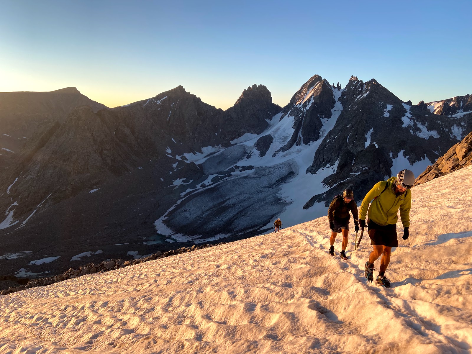 |
| Alpenglow on the Dinwoody Cirque |
 |
| Top of the snowfield in 2:00 |
 |
| Different selfie backdrop, same dads |
 |
| Daydreaming about winter (Gannett's SW couloir in center) |
Snow conditions deteriorated a bit, and the steps were softer and less secure than they were on the ascent. The ice axe plunging was nice and easy, but I'm not sure it would have held an aggressive fall. After this section, we stowed our crampons back in their sacks, where they would live for the rest of the trip.
In daylight, we cruised down the pinnacle and glacial moraine back to camp in just under 5:20. While still fairly involved, I would consider Gannett Peak via the Gooseneck Glacier a moderate outing for anyone comfortable on steep snow, especially if starting from camp in the Dinwoody Cirque. This was my second time on the peak in a span of a year, and I'm now somewhat interested in attempting Gannett in a different style, via Wells Creek in a car to car push.
Sidenote: I am glad I upgraded crampons for this trip, as I saved myself nearly two pounds. I'm also glad I didn't pack a separate summit bag, instead rigging my pack brain onto a chalkbag belt, which worked perfectly.
With Blaurock Pass looming to the south and an ambitious goal to reach the head of the Alpine Lakes drainage before sundown, we still had a full-value day ahead of us.
 |
| Exiting the Dinwoody drainage with the mouth of the Heap Steep Drainage in the far right of the photo |
 |
| Last views into the Dinwoody drainage from Blaurock Pass. Gannett in upper left |
 |
| The next pass above Knife Point Gl. seen far in the distance in the center of the frame |
And then, right at the toe of the Helen Glacier, we reached a magnificent alpine alluvial-type marsh, with cool glacier-fed water flowing over what could best be described as "seductive mud." It had the viscosity of wet beach sand, but Jerad quickly discovered that, after aggressively driving his fists and feet into the saturated glacial silt, it would loosen up and devour limbs. It felt soothing, and we spent more minutes than I care to admit wiggling our hands and feet back and forth in the grey gooey stuff.
 |
| A fine setting for forgetting your age and simply playing in the mud. Jerad, Aden, and Connor seen as specks in the middle of the frame |
Our exit from the N Fork involved crossing a slow moving, cloudy blue glacier stream, and we spent some time picking our way through the shallow points to the other side. As we traversed toward the head of the Knife Point Gl and out of the N Fork, I couldn't help but feel like we were in this special zone for far too short of a time.
 |
| More N Fork of Bull Lake Cr splendor, looking toward its headwaters from the SE |
 |
| Looking toward the Knife Point Gl, before superhuman Kelly Halpin left us in her dust |
Day 5: Knife Point Gl - Golden Lake
(Track of the Day = "Walkie Talkie" by Wand)
I woke up and had my first hot breakfast of the trip and hoooooh boy that was a real treat, especially because we would begin the day by hiking up what turned out to be one of my least-favorite passes of the entire route. It was steep, loose, and required lots of attention in the form of gingerly weighting and probing tenuously-balanced microwave sized rocks. Which is all to say that it was annoying. But thankfully, over before too long.
A snowfield more or less deposited us into the Alpine Lakes drainage, though I chose to stay on talus because I felt that the snow was a bit too firm and the angle a bit too steep. Everyone else managed it fine, but I am still a novice shoe-skier and didn't feel up to it that morning.
 |
| Alpine Lake #1 |
 |
| Scramble bramble above lake #3 |
 |
| Easy terrain for the rest of Day 5 |
 |
| Upper Golden Lake |
Day 6: Golden Lake - Middle Fork Lake
(Track of the Day = "Cow" by (Sandy)Alex G)
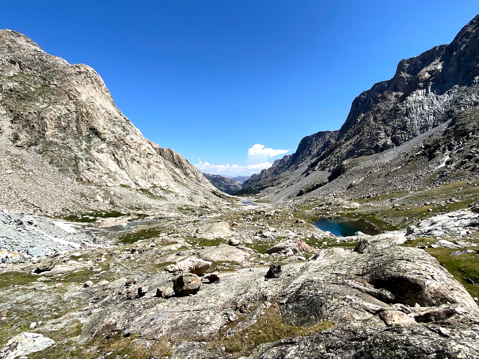
The middle of the Wind River Range is an alpine purgatory of sorts. To the north, you have a scary, dark, glacial wonderland-- Dinwoody, Fremont, Mammoth, etc etc. To the south, you have the craggy, clean, green granite splendor-- Cirque of Towers, E Fork Valley, Baptiste Lake, etc. But the middle-- or at least the section we traversed over-- is barren, high, and exposed. There isn't much water. It feels like a blank slate, with only the tops of peaks visible in any direction. For that reason, it feels like a true 'divide.'
Anyhow, mellow walking E of Dennis Lake brought us onto this divide plateau proper, where we would stay until Europe Pk. Not much to report here... just good ol' fashioned, lonely plateau-walking.
 |
| Not much banter throughout this section. |
 |
| The Mt. Victor complex provided most of the eye candy for much of this section |
On Europe Pk, we ate lunch and enjoyed our last views of the northern Winds. This really was a great spot to see both the northern section of the range, and the southern section, with clear views all the way to the Cirque of Towers.
It was funny to think that, despite having 3 days left, more or less, we had only just reached the theoretical midpoint of our route. I think that says something about the northern portion of the Winds, especially if one wants to include Gannett on their high route itinerary. Anyhow, we dropped off of the E side of Europe Pk and, on our maps, noticed some section of trail at the bottom of the S Fork of Bull Lake Creek drainage... After a burly descent, and following very, very faint traces of trail through bushwhacky terrain, our hopes were dashed, and we moved slow through what would otherwise be cruiser terrain had there actually been a trail. We were in Wind River Indian Reservation wilderness after all, and I suspect that the management for many Indian wilderness areas is a lot more hands-off than federal wilderness areas (FWIW, I think this can generally be a good thing). |
| Goodbye northern Winds... |
 |
| ... hello southern Winds (lake below Europe Pk) |
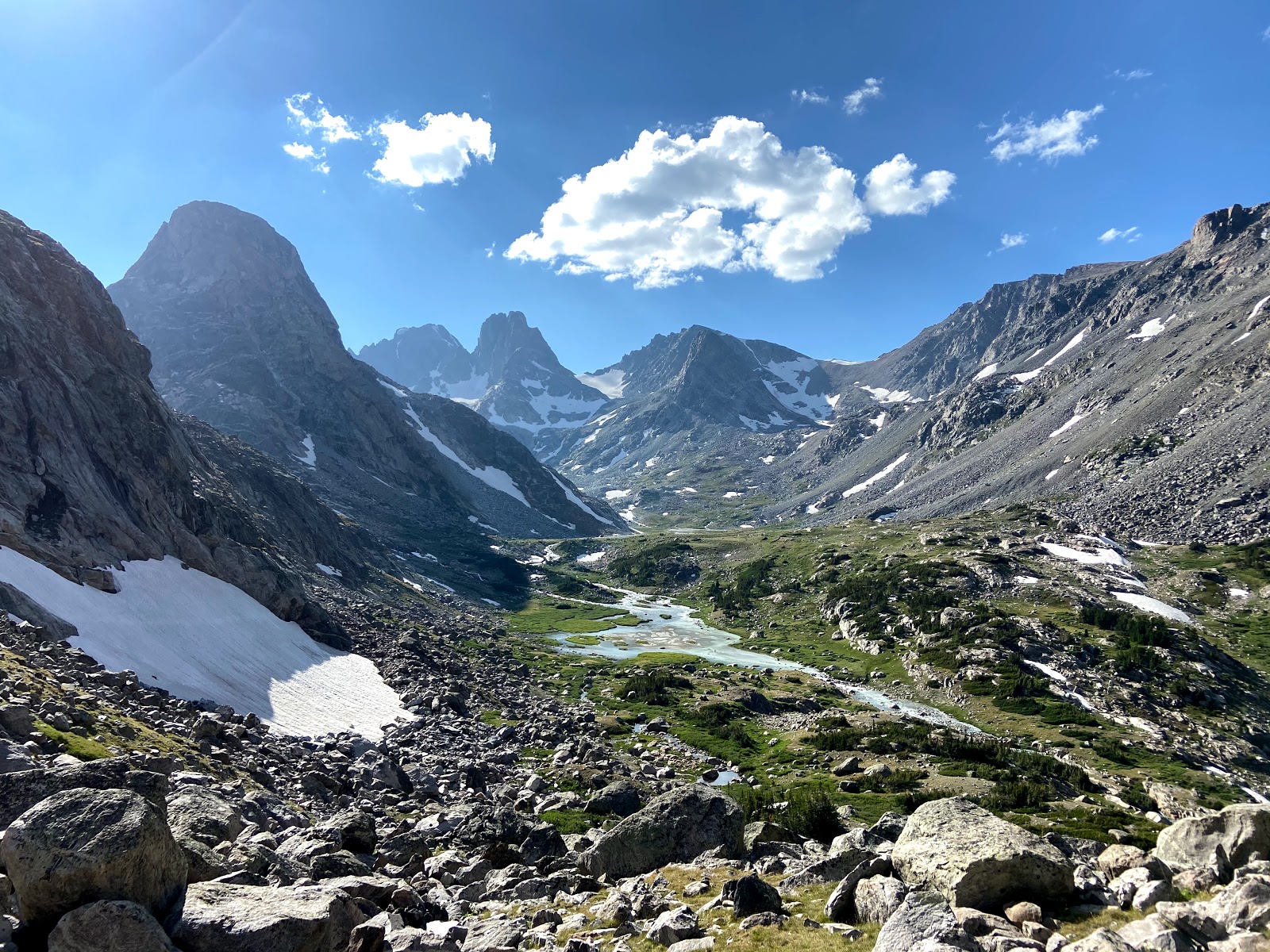
The S Fork of Bull Lake Creek eventually opened up, making the going much easier, and the views more inspiring. I couldn't take my eyes off some of the massive W facing buttresses on the E side of this drainage-- there's probably a lot of granite back here that's seen few, if any, ascents.
 |
| S Fork of Bull Lake Cr providing rich fodder for the mind-climber |
 |
| Creeks! Walls! |
Once at the top of Photo Pass, I made the descent toward Middle Fork Lake, physically-drained and mentally-checked out. The last 1.5 miles to camp went by like a dream. Mileage-wise, this was the longest day of the trip, and I felt satisfied knowing that most of the heavy lifting was behind us.
 |
| Though beautiful, I was glad to be out of the S Fork of Bull Lake Cr. |
Day 7: Middle Fork Lake - Skull Lake
(Track of the Day = "Absentee" by Cass McCombs)
 |
| Morning above Middle Fork Lake |
Day 7 started out quite pleasant with a beautiful sunrise over Middle Fork Lake. This would set the tone for the rest of this rapturous day.
We followed trail to Bonneville Basin, catching a stupid amount of trout along the way. I landed maybe one of the biggest cutthroat's of my life, and that was after a totally flubbed presentation. I guess anyone's a good fisher if you're far enough from lots of humans.
 |
| Jerad and Connor fishing along the creek above Middle Fork Lk |
 |
| Lots of small brookies, too |
The Bonneville Lakes were lovely, and I bathed, erm, degrimed, myself for the first time of the trip before ascending and descending out of Bonneville Basin and dropping into the E Fork Valley. I developed an affinity for my accumulated stench, and this was somewhat of a bittersweet moment for me.
 |
| Good rock or bad rock? |
Soon enough, we were in the E Fork Valley. I won't say much about this drainage (out of principle), and even if I could, I wouldn't know what to say-- my words just wouldn't do its splendor justice. So here are some photos. I'm hoping to be back sooner than later.
*Fades into a rhapsodic fog*
*Fades into a rhapsodic fog*
 |
| *"Some Sunsick Day" by Morgan Delt playing* |
 |


*Fog clears, fades back into reality* And then we found ourselves at Skull Lake. We would be in the Cirque by noon the next day, and so we had a party of sorts on the shore of Skull Lake. That is all I care to say about night 7!
This would be my favorite day of the trip. Cruiser, amazing scenery, and just type-1 fun the whole time.
Day 8: Skull Lake - Cirque of Towers
(Track of the Day = "Between Days" by Red House Painters)
After a somewhat slow morning, we ambled our way south to Washakie Creek. There was decent fishing along the way E to Shadow Lake, but after I stressed out and likely killed a brookie who gulped down my fly a bit too far (regretfully, I didn't bring forceps), I was bummed and put my fly rod away for the day.
Both the trail to Shadow Lake, and Texas Pass, went by relatively quick, and before we knew it, we were looking down into the Cirque of Towers. We saw a helicopter earlier in the day and wondered whether anyone got themselves into trouble. According to a hiker heading N out of the Cirque, someone did in fact get picked off of the wall. Another bummer...
But, my somber mood did not last for too long, knowing that I'd spend a mellow afternoon beneath the walls of the Cirque. And after meeting up with Bizzy and Melissa on the E shore of Lonesome Lake, that's exactly what I did! At this point, the trip felt like it was over, and it was nice to just fart around at camp all day and daydream about coming back here for more climbing-oriented objectives.
Both the trail to Shadow Lake, and Texas Pass, went by relatively quick, and before we knew it, we were looking down into the Cirque of Towers. We saw a helicopter earlier in the day and wondered whether anyone got themselves into trouble. According to a hiker heading N out of the Cirque, someone did in fact get picked off of the wall. Another bummer...
 |
| Cirque of Towers |
 |
| A proper pano of the Cirque, with Pingora on the right and War Bonnett on the left |
Day 9: Cirque of Towers - Big Sandy TH
(Track of the Day = "On the Way Home" by Neil Young)
The last day consisted of heading up Jackass Pass, and then hiking SW along the Big Sandy trail to the Big Sandy trailhead. We boogied the 9 miles of trail back to the TH and arrived shortly after noon, with libations and greasy grilled food in Pinedale dominating our thoughts. Thank you Bizzy and Melissa for making the long drive from Bozeman to Big Sandy to shuttle us through Pinedale and back to the GRL TH!
Thoughts:
- I wouldn't consider myself a 'backpacker' per se, but I think there is tons of value in doing an extended trip like this on an annual basis, especially in a range like the Winds, where this is so much country to see.
- I'm hesitant to call this Thee Wind River High Route, not only because we started at GRL and ended at Big Sandy, but also because tagging Gannett added a whole other layer of logistics. I think including Gannett into the itinerary was well worth it, especially in the grander scheme of Jerad and Aden's idea of traversing the Tetons, Gros Ventres, and Winds while tagging each range high point. Had we not climbed Gannett, I think we could have done this trip a day or two faster at the same hiking pace, and saved ourselves much weight in the form of crampons, ice axe, and helmets.
- I am not interested in coming back to the Winds to do this route, or any portions of the route, 'fast,' partly because I am not 'fast.' I felt like we went at a reasonably-moderate pace, and even then, there were still so many seemingly-neat side trips and diversions that we were forced to boogie through due to time constraints. But so is the nature of 9 day trips through massive mountain ranges...
- I think for anyone considering a high route through the Winds, a south to north traverse would be easier, due to lighter packs in the more challenging northern portion, as well as a solid base of fitness developed earlier in the trip. However, I am glad we went the way we did, since we pretty much repeated our route from last year through the northern section, and that felt more or less dialed.
- I followed an Andrew Skurka-esque nutritional regimen, where I planned out all of my calories on a spreadsheet, and then individually bagged each meal/snack. This took A LOT of time to prep, but consuming the right amount of calories without much thought in the field made all of that prep feel like it was worth it. The major drawback is that I ended up packing out 11oz. of empty plastic baggies...
- Towards the end of the trip, walking, setting up camp, transitioning from dinner to sleep-- it all felt super dialed and better than ever. I felt like I could ramble through the high country for another week, or two, or three. It's a bit ironic: despite the fitness and efficiency I built up during the trip, it all amounts to arriving back at a trailhead, to lower elevations, to a bed, to people, to proper meals- to a more vanilla lifestyle. But I suppose it doesn't have to be that way, and I try my best to hold on to the grit, fitness, and mindset that's required for these outings by bringing them to the Wasatch and other closer-to-home endeavors. But goddamn if it isn't great to take 9 days to check out entirely and focus on one singular thing in the mountains...
Stats:
- 90 miles
- 23,000 ft of ascent / 21,000 ft of descent
- 30,000 total calories consumed


