 |
| The mysterious Cowen massif |
Fall is nigh, and in turn, the season for alpine rock climbing is nearly over. Leading up to Labor Day Weekend, Nick and I volleyed plans around, and though my sights were originally set on some good ol' fashioned Tetonry, it didn't take much to convince me that we ought to do something in the Absarokas (from the Crow word "children of the large-beaked bird").
We chose the NE Arete of Mt. Cowen. Based on what we knew about the route from word of mouth and a few TR's, it seemed like a logical objective for the both of us. Lots of exposed 4th class ridgeline rambling with low 5th class and a number of 5.6 or harder sections, depending on route-finding.
We debated on whether we should go for it car to car or hike up to Elbow Lake, camp, and then climb. With law school responsibilities and SLC being a 6.5+hr drive, weekend plans in the Bozeman area are less feasible than I would like. Plus, there's a perverse appeal to doing things in a single day push. Certainly, Nick and I have probably had longer days, with heavier packs, so how bad could it really be?
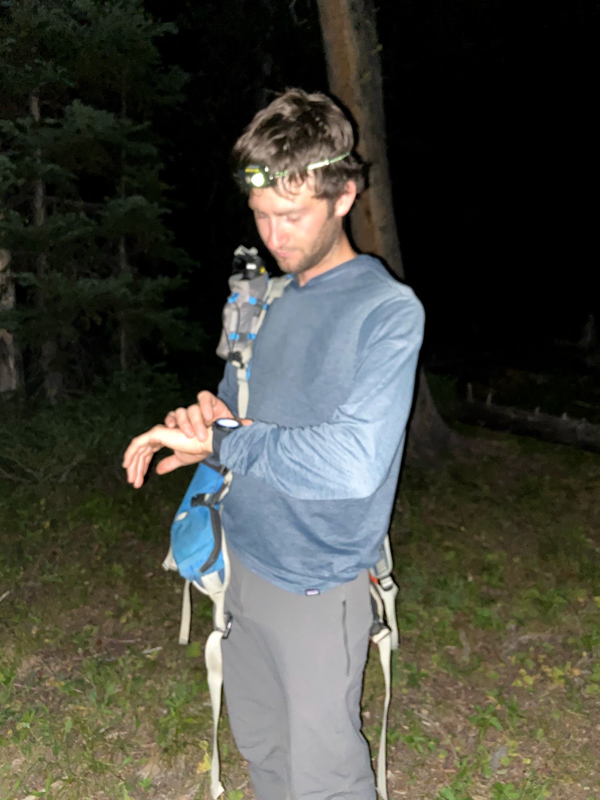
The decision was made, and we headed out from Bozeman at around 8:00 PM, while the Bridger foothills burned to the north. After some Paradise Valley hubbub, we found ourselves at the E Mill Creek TH at 10:30 PM and got to bed right away. I slept well, and was buzzing with energy when our alarms went off at 2:00 AM. After slugging some cold brew and forcing down a banana, we were off.
 |
| Starting in the (very) dark... |
Nick and I bantered all the way to Elbow Lake in 4:00, occasionally turning off our headlamps to amble in the moonlight. We then made it to the small lake in the upper basin below Cowen in 4:20, where we took our first real break of the day, refueling and filling up water bottles before heading into Cowen's rocky upper reaches. We were a bit ahead of schedule.
 |
| The Cowen Massif just before dawn. |
The grassy ledges above the lake went quickly, and we were on the ridgeline at the head of the W Fork of the West Boulder River in 5:20, where the first glimpse of the climb came into view.
 |
| Grassy ledges and the Cowen Massif |
 |
| Cowen's NE Arete; its start, partially obscured by more beautiful rock. |
The NE Arete is on the lonesome "other" side of Cowen, and there's a steep snowfield guarding its entrance gully. Aden told us that he managed to avoid the snowfield in August years ago, so to save weight, Nick and I decided to leave the crampons and ice axe at the trailhead. Indeed, the snowfield melted out just enough to allow us passage. Nice! If not for this, the day probably would have been considerably longer, if not over altogether, as the snowfield was steep and bulletproof.
 |
| Nick sneaking around the snowfield |
The NE arete is accessed via a hidden gully directly across the snowfield. We made quick work of the gully, which wasn't too loose, and eventually reached the notch. Goddamn, there's a ton of really good looking rock back there.
We started up the NE Arete proper, which is the second abrupt ridge from the notch, in 7:00. The first ridge one encounters on the left looks like it goes at a much harder grade, and it meets up with the NE Arete in a few hundred feet anyway. Think I saw some bail slings on it... perhaps some folks got fooled.
Getting onto the ridge was more or less straightforward, and we simuled with a doubled-over 60m twin rope until reaching a vertical handcrack. We short pitched this small section-- it felt like full value Montana 5.6. Turns out, jamming in approach shoes is surprisingly secure, and nearly delightful, especially at hand+ sized cracks. After this, we simuled a very long, rambling, and type-1 ridgeline pitch. It was fun to open it up here and move real fast, as the climbing stuck to the spine of the ridge and was not uncomfortably exposed.
Soon after, the terrain became much more complex and exposed. It kind of went like this: 15' section of 5.6ish rock, ledge, blocky ridgeline maneuvering, 15' section of 5.6ish, etc. etc. It became evident that short pitching with a 60m twin doubled over (effectively a 30m) was taking way too much time, so we switched over to leading/simuling with the 60m twin in single rope style.
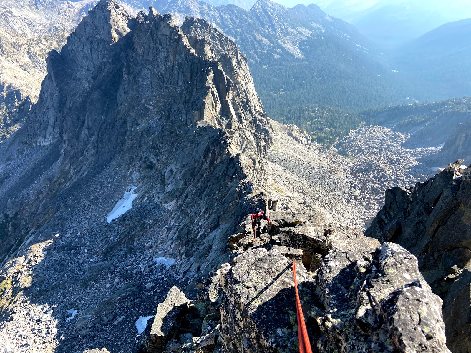 |
| The 60m twin-as-a-double rope technique worked for a little while, but ultimately, we realized that we would need to pitch things out a bit more. |
The ridge continued in the aforementioned fashion, and there were lots of nice big ledges to rest, regroup, and swap gear. As we progressed, the most effective tactic seemed to be a hybrid between simul technique and pitching it out; where the leader would get to the end of the rope, build an in situ, hasty anchor and belay up the second from the harness just until the second got past the crux(es), and then break down the anchor and continue climbing. Not sure if this is the safest method, but I think it suited the style in which we wanted to climb the route, i.e. absolutely no falling, but still employing some catastrophe insurance (not 100% confident I'd be comfortable soloing the entire route).
The ridge kept delivering, and got more and more daunting as it thinned out about 3/4 of the way from the top. Bailing off of this route would be a major undertaking on many accounts, and that felt more and more real as we got closer to the summit. The last memorable section of 5.6ish climbing was this beautiful large-hands crack on amazing rock. After that, it was one long, moderately-exposed simul to the summit, where I ran out of gear way too early and had to get inventive with the remaining materials on my harness. We did use a lot of tri-cams, and I totally take back everything I said about 'em, Nick!
 |
| Strawberry Creek: a long way from lots of things; most notably, a nearby trailhead. |
 |
| Near Cowen's summit |
Cowen's summit is a 15 ft pinnacle that requires some mellow climbing with one very exposed (perhaps optional?) move. We topped out in 11:40, and I consumed my first calories and water since starting up the climb. It took us about 4.5 hrs to get through the technical climbing. Though this wasn't my longest day on rock, it certainly was the most vertical feet I've covered in this amount of time.
 |
| An exposed step-around move to the summit that we probably didn't have to do |
 |
| Setting up the small rap off of Cowen's summit proper |
 |
| Bon voyage, Pepe! If only we could've rapped the entire route |
We still had a lot of vert to lose (5.5k) and miles (~8-10) to cover. The descent is a 4th class series of ledges and slopes on the south side of Cowen, leading down to Elbow Lake. It kind of sucked, but as these things tend to go, it also kind of just 'happened,' and we were back down to Elbow Lake in 14:30.
 |
| Count Mowen! |
We ate in the meadows near Elbow Lake and drank some water as the sun went down. With a full belly and a slightly lighter pack, we were ready for the death march on the dusty Elbow Lake trail back to the truck. For a while, we tried jogging, but our feet hurt :( -- thanks, old approach shoes!
 |
| Guide Tennies-- good for jamming fatty alpine cracks, bad for running on steep dusty trail. |
The sunlight began to fade, but I refused to turn my headlamp on for the second time of the day. We arrived back to the car in complete darkness in 18:20, with a bit of fatigue and heaps of satisfaction.
In hindsight, climbing Cowen would have been a lot more 'fun' from camp. But having fun is much less cool.
Stats:
- 23 miles
- 2,000 feet of semi-technical/technical climbing
- 7,700 ft of vert overall


